
 MENU
MENU

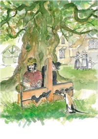
Saxon burial
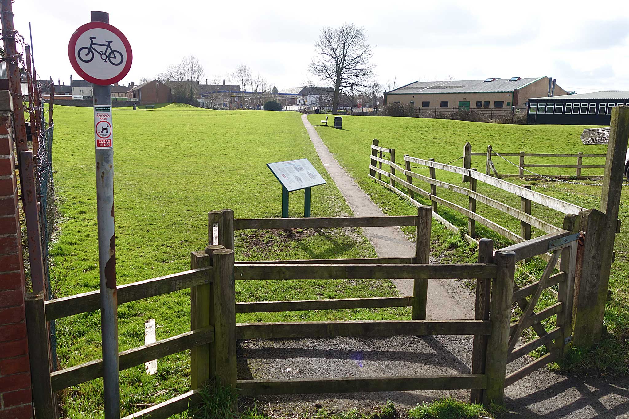
Board 1: Saxon burial 
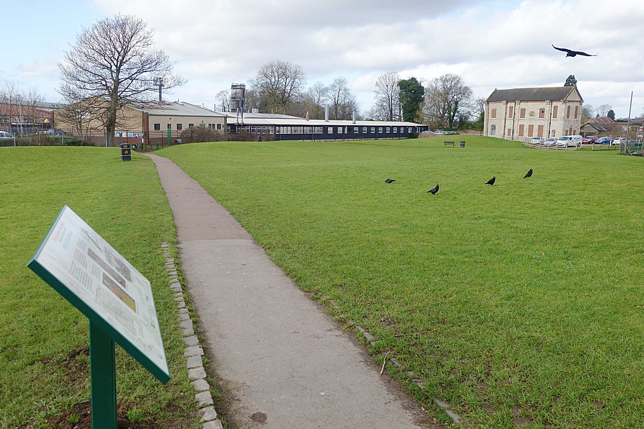
To begin the walk go to the west of the Market Place (Ripon direction) and enter Castlegate. Take the alley on the right beside Lee’s butchers which leads to the grassy area of Castle Garth, the site where Thirsk Castle once stood and where you will find board 1 on the left of the path.
In the summer of 1994 an archaeological excavation took place on this part of the site in connection with the installation of a sub-station by Northern Electric. The dig revealed a hitherto undetected sixth-century burial site. This discovery confirmed the belief that Thirsk existed as a settlement long before the arrival of the Normans in the late 11th century.
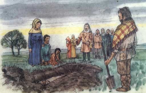
When the Roman Legions were withdrawn from northern Britain in AD 402 there were already people from the north-western part of Europe settled here as part of the Roman army and as time went by they were joined by more immigrants from across the North Sea. The folk settling in Yorkshire were Angles rather than Saxons and by AD 560 an Anglian chieftain called Aella ruled over a north-eastern kingdom called Deira. The graves found here belong to the first half of the sixth century and the artifacts associated with them are in a typically Anglian style.
The archaeologists found that graves had been disturbed at a later date, probably when the castle ditch was dug, but had not been robbed. From the size of the bones found in one of the graves we know that the man buried there stood about seven feet - well over two metres - tall. Were there giants in those days?
Full details of the 1994 dig and the finds from the site can be found at Thirsk Museum in Kirkgate.
Board 2: Thirsk Castle
Go down the slope to the next board
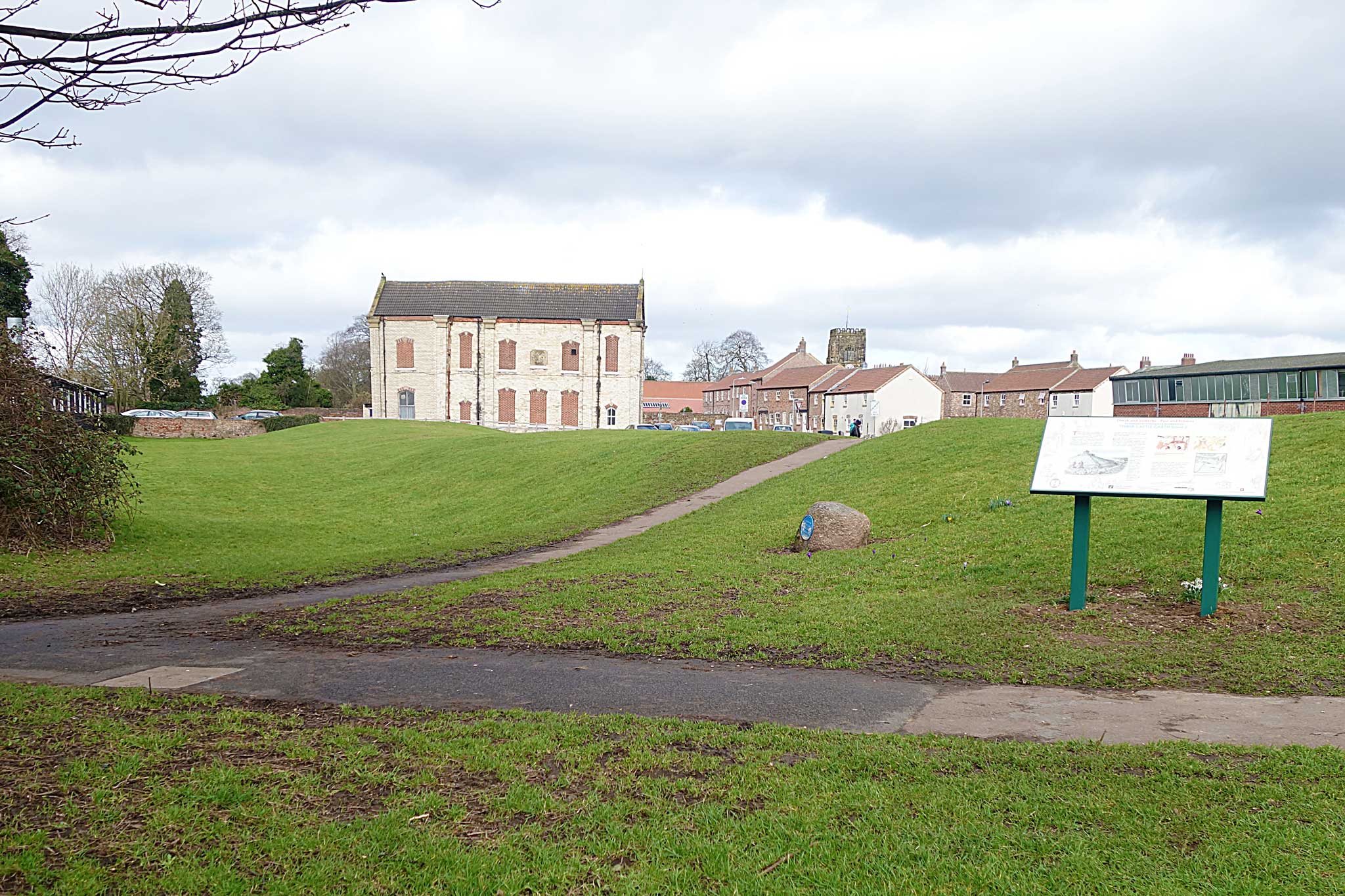
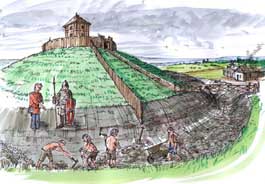
Thirsk Castle was an example of a motte and bailey construction. This was a style brought to England by the Normans and was the simplest type of mediaeval castle. The motte was a conical mound of earth or rubble on which stood a timber tower. This stronghold could be surrounded with a ditch and a palisade. Around this stretched a level open space, the bailey, enclosed by a rampart formed by earth thrown up from a ditch on the outside; the rampart was in turn topped by a stout palisade.
Castles like this were built in the early stages of the Norman Conquest as garrison forts in strategic positions; over six hundred examples have been recorded. Many later became aristocratic residences and administrative centres, the more permanent being rebuilt in stone. Thirsk Castle never developed beyond its initial stage and was demolished before the end of the 12th century. Nothing of the fabric of the castle is visible, but the late-Victorian Castle Villa stands in a prominent position on the remains of the motte. The western limit of the bailey is still marked by the impressive rampart which lies in front of you and the ditch where you are now standing. Over the centuries, and especially in more recent times, buildings have encroached upon the site. Castle Garth itself, however, has never been built on - it has served as garden or paddock down the years and is now adopted by Thirsk Town Council and preserved as an open space for the enjoyment of the community.
Board 3: Norman conquest
Turn right, taking the footpath that leads across the grassy area northwards to the next board.
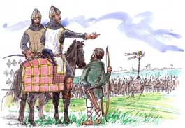
After William’s conquest of England following the invasion of 1066 the Norman barons were rewarded with vast tracts of land. Thirsk and its surrounding region formed part of the estates of the powerful Mowbray family and the building of a castle on this site was probably carried out around 1092 by Robert de Mowbray who was then Governor of Northern England. It was from Thirsk that Robert de Mowbray marched north to defeat an army of invading Scots led by their King Malcolm who was cornered and slain at Alnwick.
By the time of King Stephen (1135-1153) Thirsk Castle was the home of the young Roger de Mowbray and his widowed mother lady Gundrea de Albini. In 1138 a group of twelve monks led by Abbot Gerold arrived in Thirsk. Four years earlier they had been sent from their Savigniac monastery at Furness to found a new abbey at Calder in Cumberland, but fleeing from marauding Scots, they had come to Yorkshire to find a place to establish themselves. Gundrea sheltered them here in Thirsk before sending them on to settle at Hood on the edge of the Hambleton Hills where her uncle lived the solitary life of a hermit. It was these monks who, after several abortive attempts at establishing a permanent monastery, exchanged their Savigniac rule for the Cistercian mode and, with substantial grants of land, founded Byland Abbey in 1177.
In 1138, the year the monks came to Thirsk, there was renewed fighting with the Scots who had swept through Northumberland and Durham and across the Tees. They were opposed by the Yorkshire barons led by Thurstan, Archbishop of York. To encourage the English army, the Archbishop contrived a great mast mounted on wheels, topped by a casket holding a consecrated wafer and flying the banners of the four patron saints of the North; it was to be the rallying standard in the fight that was to follow. Mustering at Thirsk, the barons marched to meet the Scots just beyond Northallerton, where the English army routed the Scots in the Battle of the Standard and drove them back beyond the Tees.
In the years that followed, Roger de Mowbray joined the party of Prince Henry in rebellion against Henry II. Roger had backed the losing side, however, and though pardoned by the King, his castles were declared forfeit and destroyed in 1176.
Board 4: Sluice gate
Turn right along Pick’s Lane, named after a Mr. Pick who had a farm opposite the kissing gate. The farm has been redeveloped and houses built on the site. Go down Pick’s Lane to enter Kirkgate. Opposite the junction is the site of Rhodes Brewery, now converted into flats. It was one of two breweries that existed in the street. Thirsk Museum is to the right. Thomas Lord, famous for founding Lord’s Cricket Ground in London, was born there.
At the northern end of the street is the Parish Church built in the Perpendicular style and dedicated to Saint Mary. Other buildings of interest are the World of James Herriot where Alf Wight (his real name), the famous vet and author, had his surgery and Thirsk Hall, the home of the Lords of the Manor. Walk towards the church and cross the road.
Take the footpath to the left that runs parallel to the main road and is left of the river. Walk for about 300 yards (275 metres) to get to board 4 positioned near the sluice gate.
The Sluice gate is one of the last remnants of the Thirsk Mill which stood where the present Mill Gardens are situated. The old map (left) shows us the extensive nature of the mill and its component parts.
The Thirsk Mill was an undershot one, usual in lowland areas, and was used for milling a variety of materials over time including corn. For a mill to work there needs to be a regular supply of water and this is provided by a Mill Race. The sluice gate regulated the supply of water from the Cod Beck into the Mill Race. The weir alongside it dammed up the water in the river to assist the operation of the sluice gate. The Mill Race ran alongside the Northallerton road and then down what is now the Marage Road before being utilised to power the mill wheel. The top of the Mill Race wall can still be seen at the edge of the grass alongside the footpath next to the road. In the kerb stones you can still see the slots into which the fence posts were fixed.
The miller was therefore not dependent on the vagaries of the supply from the river; he could control when and how much water he required to undertake his milling.
The area between the Mill Race and the river provided an attractive grassed area which was used for recreational purposes by the people of Thirsk (see the Holmes board ). Bridges crossed the Mill Race including Church Bridge near St Mary’s Church.
The mill fell into decline and was shut in the 1960s and the decision was taken by the Thirsk Rural District Council to fill in the Mill Race.
The cottages of Norby (opposite) which had been condemned as unfit for habitation were pulled down and the rubble used to fill the Mill Race.
The sluice gate and the weir (locally known as the waterfall) are all that remain of the original extensive mill workings. The sluice gate at the mill end of the Mill Race was removed in recent times.
Glossary
Sluice gate - consists of a gate, usually of wood which can be opened or closed using mechanical guides. You can still see the remaining mechanism’s screw.
Mill Race - stream of water above the mill wheel
Weir - dam across stream to divert water to the mill
Undershot wheel - wheel driven by impulse of water passing underneath.
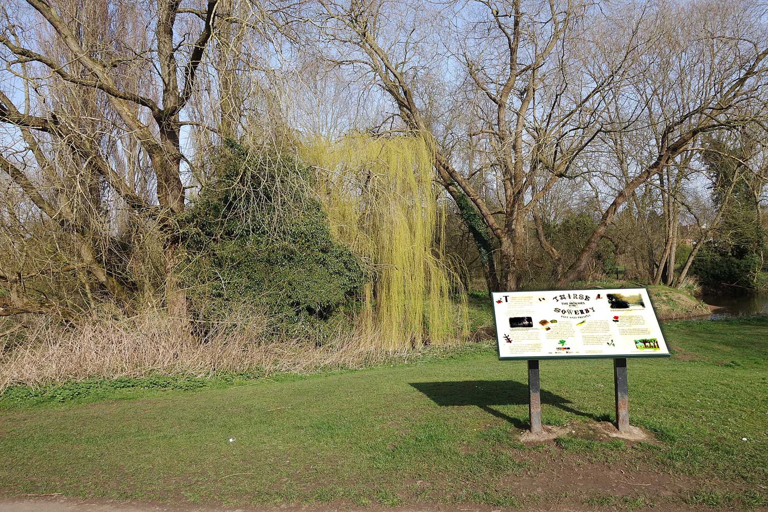
Board 5: The Holmes
Retrace your steps along the footpath in the grassy area to reach board 5.
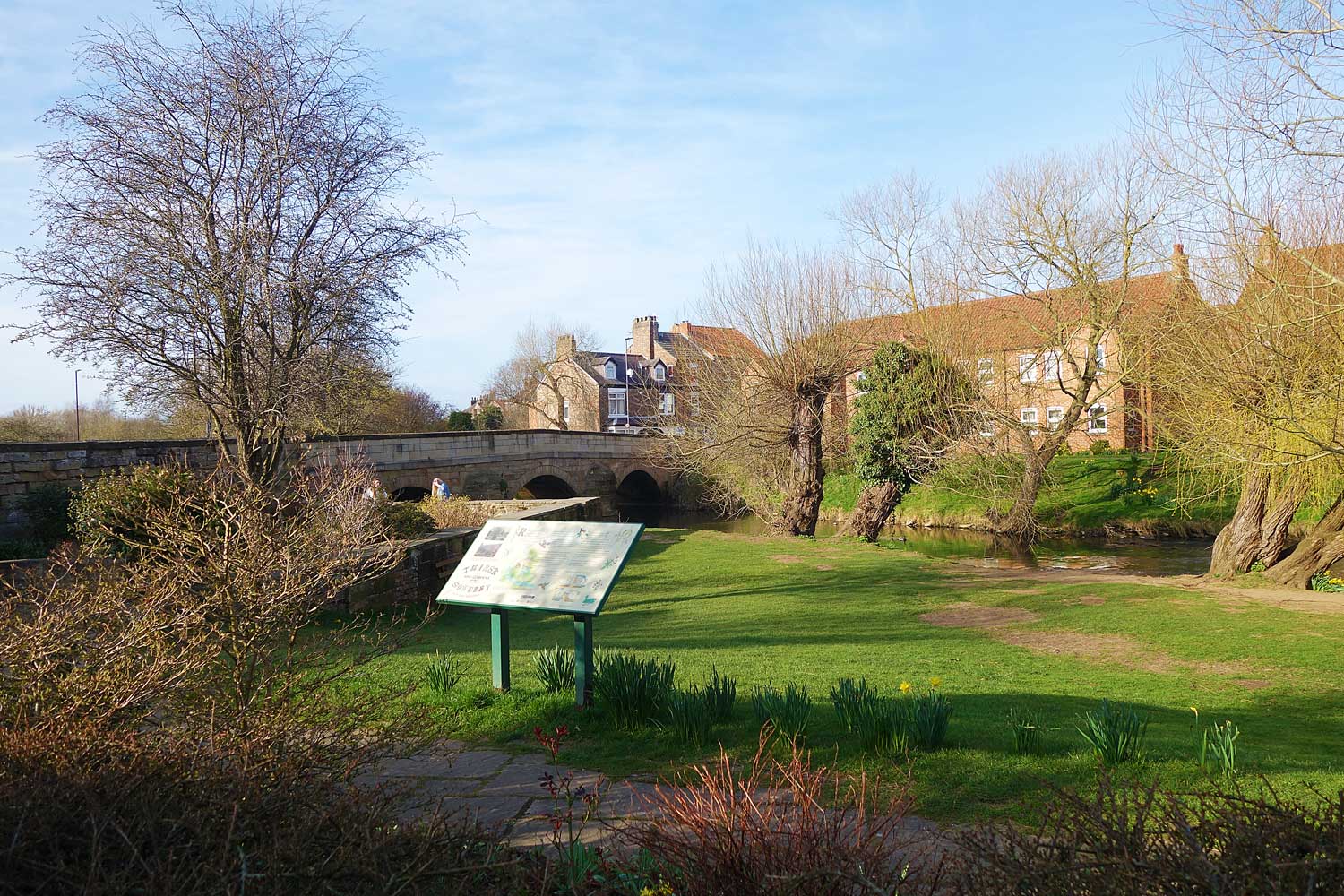
The Holmes is an area alongside the Cod Beck, a stream whose name means Cold Brook. The river is about 22 miles long and has 7 bridges. In the Holmes area the Whitelass Beck feeds into the Cod Beck.
At one time The Holmes was said to be "possibly the finest Willowgarth in the County", and John Gilbert Baker, Keeper of the Herbarium at Kew Gardens, wrote of it as a fine grove of tall willows with straight stems. Straight and pliable stems were then needed for the basket-weaving industry in Thirsk and were achieved by cutting the willows annually to provide new growth of slender shoots. The trees were pollarded (cut at height) or coppiced (cut at base), both of which methods promoted growth from dormant buds in the tree.
Many of the tall and graceful White and Crack Willows still flourish in The Holmes and are maintained in the traditional way. The lower-growing Osier can also be found along the far bank of the Cod Beck with more recently planted Weeping Willows. In June, look out for the beautiful Dame’s violet in all shades of lavender along the banks of the beck.
Where the beck turns east towards the Green there was once a spring of "pure and excellent water, commonly called Lady Well." No doubt this well was dedicated to ‘Our Lady’, the Virgin Mary, possibly in the early days of the present church, when its water may have been used for baptism and in other church services. A hundred and fifty years ago the spring was said to be "plenteous", and was protected by a triangular cover of stone, but today nothing is visible to denote the exact position of the well.
In 1642 the Cod Beck was referred to as the "Broad Beck leading to Thirske" and there is little doubt that today it is greatly diminished in size, perhaps due to the draining of the land and also the drawing off of water from the streams that feed it before it reaches Thirsk. In spate it is still a formidable force and in both the past and recent years has caused widespread flooding in low-lying parts of the town and countryside.
Opposite Thirsk Hall there is an area now enclosed by railings and only glimpsed through gaps in the hedge. It is the site of an artificial pond known as "The Marage" or "Marriage" and recorded in 1859 as "A shrubbery, fish pond and rural aquarium for fancy poultry, and scarce specimens of the goose and duck tribes."
There have been several theories about the name; a Victorian writer suggested it was originally "The Mirage" and added "no park or grounds before the withdrawing room windows were complete or correct without a lake and where you could not have a lake they had a mirage…." Locals talk about the "fine skating enjoyed there in winters past."
The Holmes was a popular Edwardian pleasure ground used for promenading in Sunday best and general entertainment. Thirsk sports were held near here in Carr’s field from the 1920s until the 1960s. The area is still favoured for outdoor activities.
Board 6: Moated site
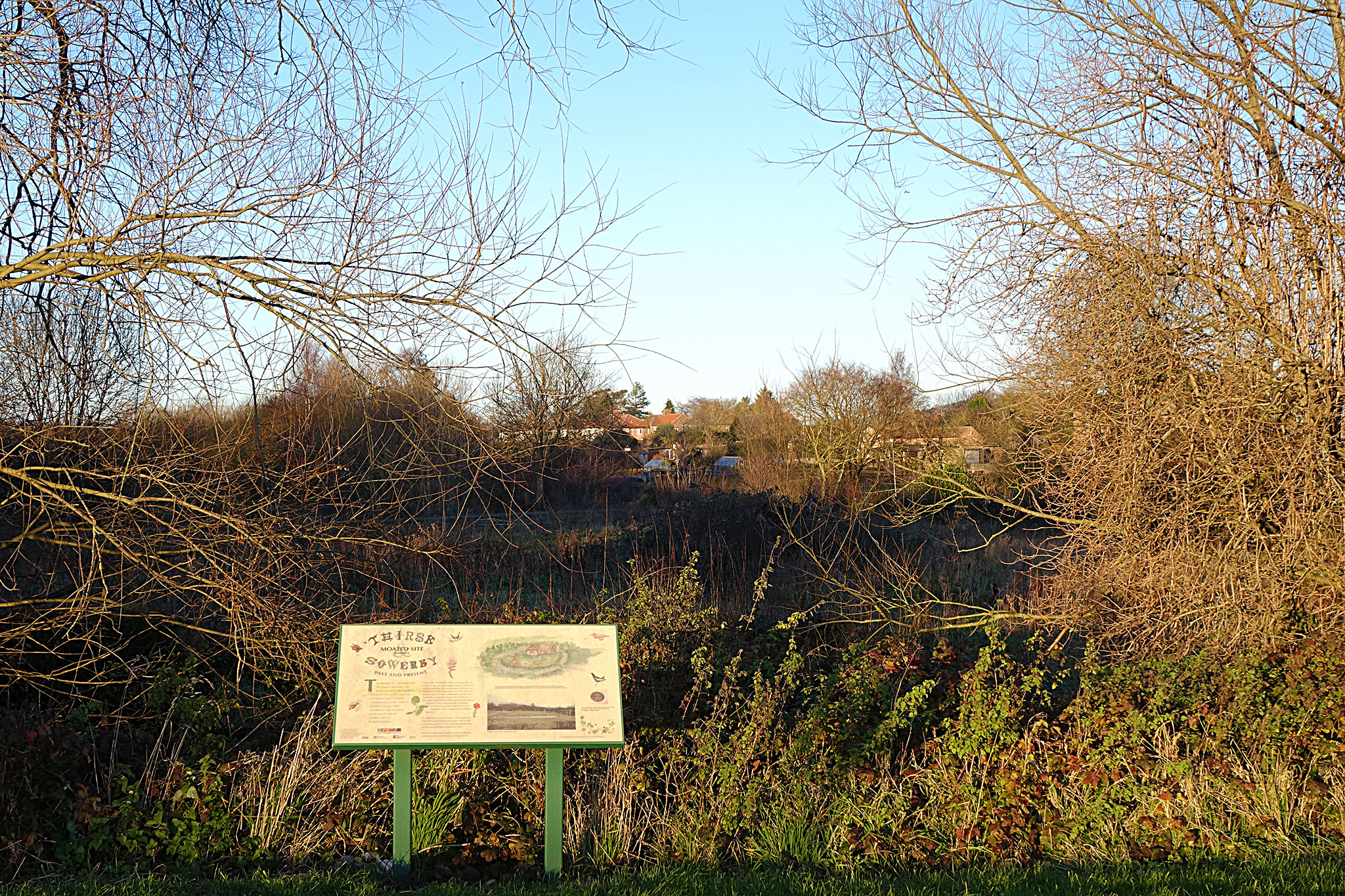
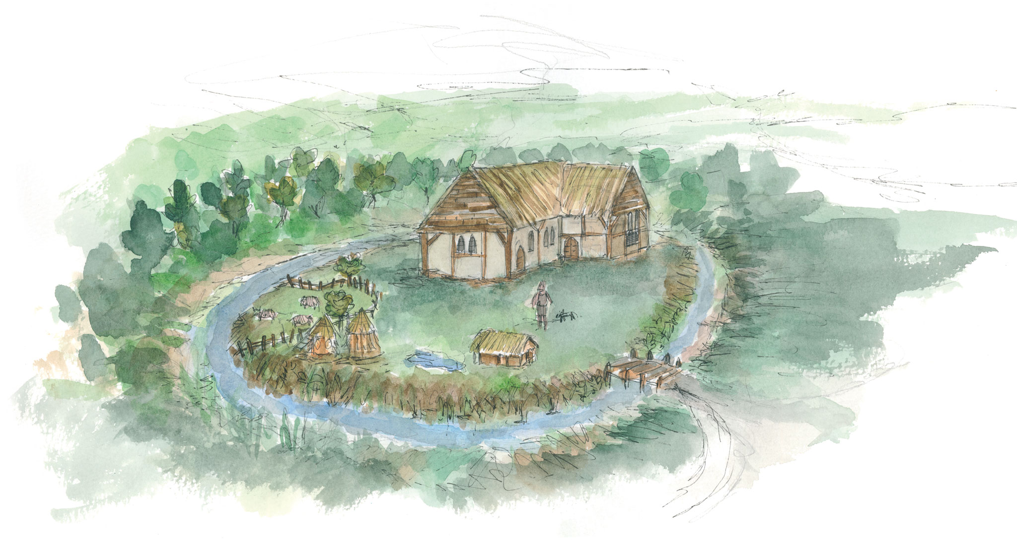
Continue on the footpath towards the eastern end of the church and then turn left along Marage Road to find board 6 which is near the Moated Site on your left.
The moated site, also known as the burgess enclosure, lies inside a bend of the Cod Beck and is one of several in the area. It is situated near a possible crossing point, a ford, which is thought to have existed between the east end of the parish church and the northern area of St. James’s Green.
The site dates from either the 13th or 14th century and is not as large as many others built during the period. It consists of a small level area which lies a few feet above water level and is surrounded by a ditch or moat which can still be seen in wet weather or flood. On it was a homestead or possibly a small manor house, occupied by a burgess or free landowner. As many other moated sites the ditches were hardly for defensive purposes but were constructed by the low-ranking manorial lords as a status symbol or as a mark of prestige, the owners wishing to ape the wealthier landowners.
An archaeological survey of the site in 1993 reported that whilst nothing of the buildings (most likely made of wood) remains above ground level, the waterlogged deposits here may have preserved features beneath the surface.
The site was added to the schedule of nationally important ancient monuments in 1993 and so is protected by law.
Board 7: Mill Gardens
Continue along Marage Road to reach Millgate. Cross the road and immediately to the left is board 7 which is located in Mill Gardens. It gives information about the workings and site of the former mill.
Rymer’s Mill stood here and this garden marks the site. The mill was active in grinding cereals into flour and for producing cattle feed for local farmers for many years.Originally the Mill was water powered using the ‘undershot’ method – the ‘undershot’ wheel is probably the oldest type of waterwheel having been developed over two thousand years ago. Undershot mills were fairly simple to build and could be placed into a rapidly flowing stream with a minimum of site preparation. The water to power the Mill came from the Cod Beck (see Sluice gate board 4 for details).
The Mill was a large three-storey brick building 120 feet (36m.) long and 36 feet (11m.) wide with a pantile roof. Several courses of stone were incorporated into the east wall at ground level, possibly indicating the remains of an earlier mill. There were two internal water wheels in the mill, the central one being about 12 feet (3.6m.) wide and 16 feet (4.9m.) in diameter. These powered the millstones which were used to grind the locally-grown grain. In 1855 a boiler house and chimney were added for a steam engine, later replaced by an oil engine.
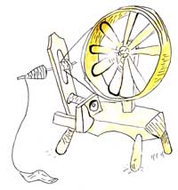
At one time, part of the mill was used for grinding dried tobacco leaves to produce snuff. It was also used for making sacking and coarse cloth, possibly from the hemp which at one time was grown on the banks of the Cod Beck. One other use of the mill was cotton spinning – the scheme was short-lived, but ran for a couple of years before the machinery was sold off. At the end of Millgate is an area known as Dyer’s Yard where the cloth was coloured and dried on long lines across what is now the car park. The drying ground is shown as the Tenter Garth on the Tithe map - cloth was stretched on "tenter-hooks" hence the expression "to be on tenterhooks."
The mill was active up until the early 1960s, when it was demolished and the area landscaped and developed into the garden area one can see today.
Board 8: Saint James Green
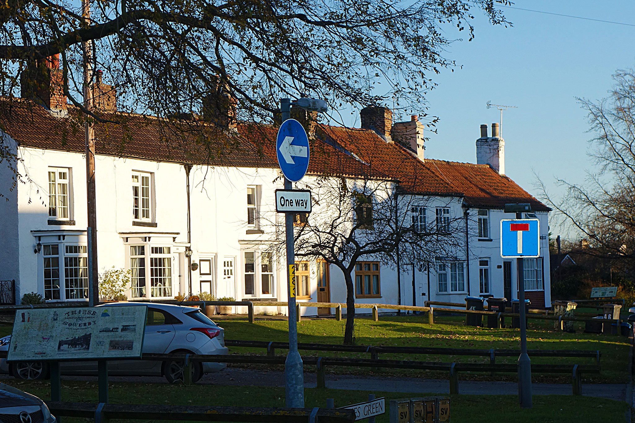
Cross the bridge to enter Bridge Street. This leads to Saint James’ Green and the adjoining Little Green on the right. These areas are the original site of the town. Where the road turns left cross to find board 8
In the foundation charter of Newburgh Priory, granted by Roger de Mowbray in 1145, it states that there was a chapel dedicated to St. James on the Green but there is now no trace of the chapel that gave this spot its name.
In times gone by this area was the centre of the craft industry – leather-working, fellmongery, carpentry, plumbing and joinery. The cattle market was on the Green and in 1859 the rates for cattle were as follows:
Beasts - 2d. Per. head
Bulls - 4d. Per. head
Sheep - 8d. Per. score (20)
Tups - 2d. Each
Horses - 4d. Each
A further record calls attention to the fact that inhabitants of the Green, ‘suffered considerably through cattle and sheep straying thereon on market days’. Probably because of this a number of houses on the Green used to have protective shutters fitted to ground floor windows for use when markets were in progress.
John Wesley introduced Methodism into Thirsk when he visited the town in 1747. He visited Thirsk on thirteen occasions between 1747 and 1788 and on the occasion of Easter Monday, 21st April 1747, he found the town full of holiday folk drinking, cursing, swearing, and engaging in cockfights. He said, ‘I did not stop at all but rode on to Boroughbridge.’
The first Methodist Chapel was octagonal and built between 1764 and 1766. This was pulled down and another erected in 1816. This in turn was demolished in the 1960s and the present chapel is in a building formerly used as a schoolroom which was added to the original Methodist Chapel in 1908.
In more recent times, Nurse Bell’s Nursing Home was situated on the Green and the children of Alf Wight (who is better known as James Herriot) were born there.
Board 9: The Little Green
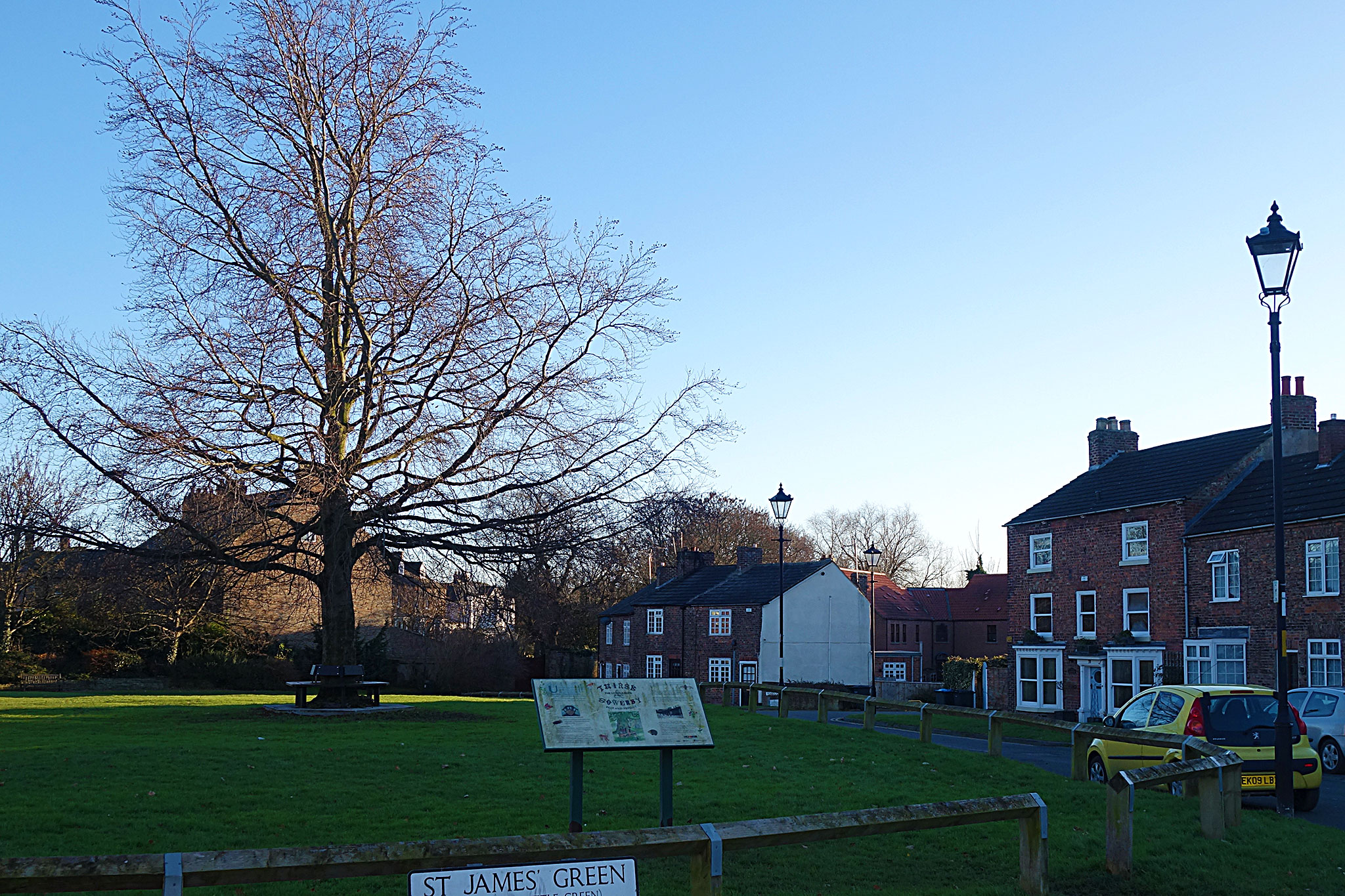
From Saint James Green walk the short distance to the right towards the solitary tree in the centre of the grassy area. This is Little Green where board 9 is located.
Until 1818 a large elm tree stood on this site but on November 5th of that year, a group of mischievous boys set fire "to this piece of vegetable antiquity". However, sufficient wood was left of the tree to make two substantial chairs for John Bell, Esquire – the lord of the manor.
The Great Elm was the place in years gone by where election results were declared and where the town stocks were located.
A quote from 1655: - "Richard Barton, otherwise Chapman, was ordered to sitt in the stocks three houres, for that he was convict of prophane swearing at Thirske and did undergoe that punishment at Thirske this session."
In 1489, Henry VII demanded heavy taxes to finance a war in France. The northern counties fiercely objected and Henry Percy, the 4th Earl of Northumberland and Lord Lieutenant of Yorkshire, was despatched to collect the money, but there is a local legend that he was dragged from his home in Topcliffe and put to death by a mob near the Great Elm.
In the 19th century human bones were found near the old elm tree which points to there having been a burial place attached to the ancient chapel. (see board 8)
In the south-east corner of the Little Green there used to be the town’s Pinfold (a pound for stray cattle). The animals were collected from around the town and a fine was charged to have animals released.
There used to be old cottages to the east of the Little Green but these were pulled down and replaced by the modern houses (some of which were for workers at Austin Reed when that company moved to Thirsk in the 1970s).
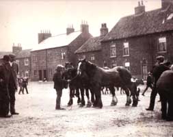
The photograph, taken about 1906, shows the ‘Dolphin and Anchor’ on the Little Green not long before it closed down. The thatched roof was an unusual survival at a time when buildings were roofed with tiles or slates, but it gives an idea of what most houses on the Green would have looked like in the first half of the nineteenth century. There were at one time six public houses round the Green, serving the needs of drovers and dealers in the days when cattle markets were held here. Only The Lord Nelson survives today.
Board 10: Canal Wharf
Continue in the same direction southwards from the Little Green along the path that leads beside the river. Note the Victorian houses of The Crescent on the left. On reaching Ingramgate cross the road and follow the footpath through the garage premises to board 10 sited near Canal Wharf.
In the year 1761 the Bridgewater Canal was built, eventually linking Manchester with Liverpool and contributing significantly to the growth and economic development of these two cities. This canal and its success led to the making of many more and the British canal system as we know it today developed between 1761 and 1830.
Roads were very bad in the 18th century and transport by canal was comparatively easy and quick. It was said "you could carry by canal for one pound what would have cost five pounds to carry by road."
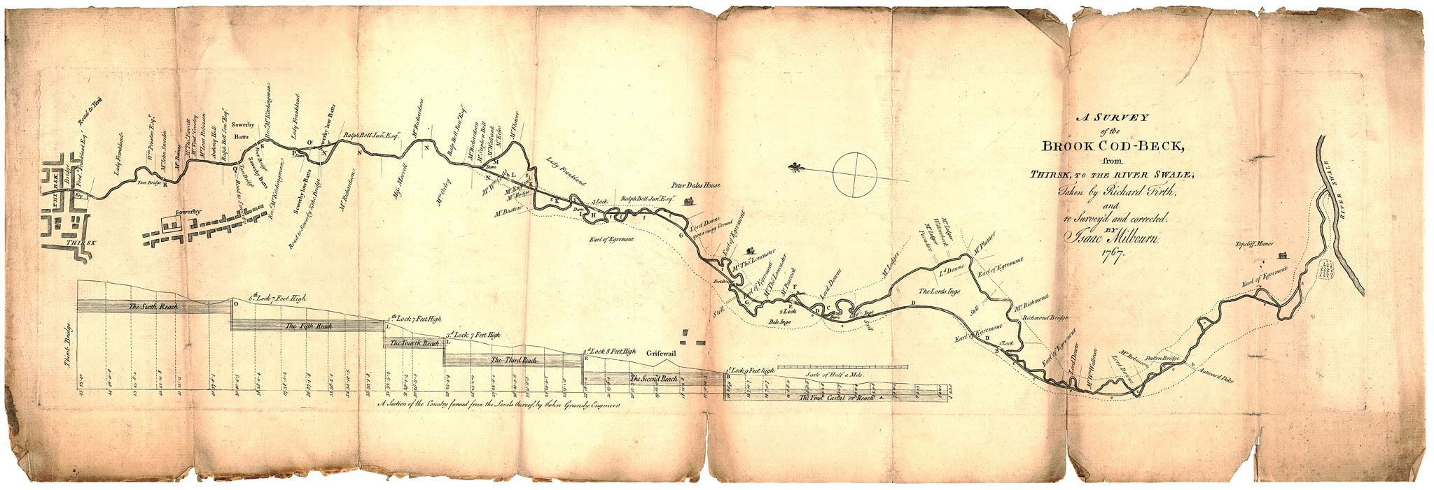
In 1763 an Act of Parliament was obtained for making the Cod Beck navigable from its junction with the River Swale to Thirsk. The difference in levels was found to be only thirty-six feet (eleven metres), requiring five locks to keep the water at the correct height.
Work began at the Thirsk end, a basin was constructed for the vessels and a wharf built for the landing of goods; a lock was erected at Sowerby, the river deepened and its course straightened from the wharf to the lock.
Funds for the scheme failed and the canal was never completed; however, evidence still remains of the enterprise. Parts of the wharf can still be seen complete with iron rings to which the barges would have been moored. Had the scheme been realized there would have been considerable advantage to the town and trade of Thirsk.
Take a walk along the river bank to the south-east corner of the Flatts field to see the remains of the lock in the form of a foot bridge (Lock Bridge).
Board 11: Pudding Pie Hill
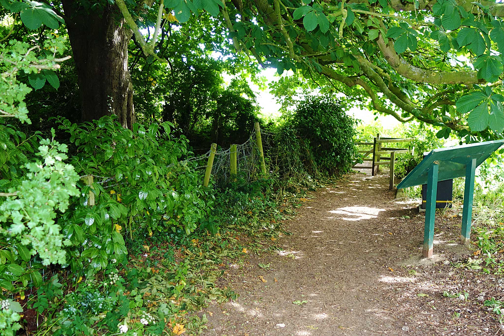
Cross the stream and field, forking right after the gate. Follow the grass footpath beside the river. It can be muddy at times. Note that part of the river was straightened in preparation for a canal system. Take note of the fields on the opposite side of the river which show evidence of the ‘ridge and furrow’ method of ploughing.
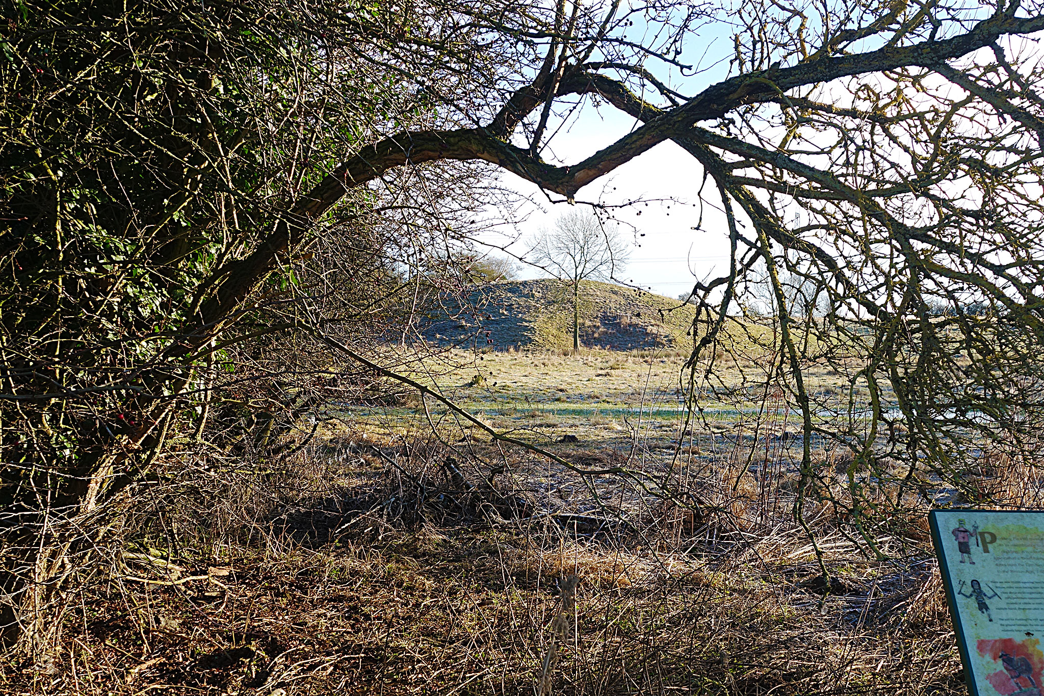
Do not cross Lock Bridge but continue southwards along the path. This follows the river and may be rather muddy after rain. There is much wildlife in the area and kingfishers are often seen here. Cross the road at Blakey Bridge and make the short detour to board 11 at Pudding Pie Hill. This is an ancient burial mound, at least 2,500 years old, which is clearly visible from the bridge.
Pudding Pie Hill owes its name to its resemblance to a pie or pudding. It is a burial site of a type called a ‘bowl barrow’ which dates from the Late Neolithic period to the Bronze Age, 2400-1500 BC.
There are over 10,000 surviving bowl barrows in lowland Britain, many more having been destroyed. They give us clues about social organisation and beliefs amongst
early prehistoric communities. Constructed as mounds of rubble or earth to cover a single or multiple burial, they were often re-used in later periods.
The soil for Pudding Pie Hill appears to have been taken from the ground between the site and the Cod Beck. The barrow is relatively large and has been well preserved. Though the ditch that surrounded it has become silted up on the flat ground, there is evidence of its original size (between 5m and 10m wide and up to 1.5m deep) where it cuts into the hillside.
There is a slight irregular hollow at the top of the mound, thought to be the result of an excavation in 1855 by Lady Frankland Russell, the then owner of the land.
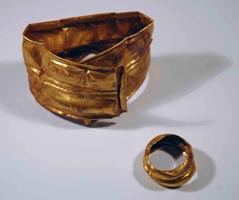
The excavation revealed three male skeletons, cremated bones, funeral urns, and Anglian weapons in graves at varying depths in the mound, demonstrating how it was re-used by Anglian settlers (from the Southern Danish Peninsula) in the 6th century.
Of the three male skeletons discovered, only one lying above the other two and at a depth of about 5m from the summit, was recorded in detail. The description was ‘of a warrior apparently of more than ordinary size; his shield, the central boss of which remained with the rivets which held it to the wood, rested on his breast; by his right side lay the handle of his sword; so it is thought he may have been buried in full dress with all his arms and accoutrements.’
The furnishing of a male body with arms may have been to assist his journey to the after-life or provide him with the belongings he would need there. Some of the relics from the excavation were presented by Lady Frankland Russell to the Yorkshire Museum.
Of note is a possible connection between the ‘warrior’ found here and an Anglian man of similarly unusual height (7ft or well over 2m) discovered in a 6th century grave near the site of Thirsk Castle. (The interpretation board in Castle Garth gives more details).
Until the mound at Pudding Pie Hill was opened, its origin had been a source of conjecture and there were tales of its magical properties. It was said that if you ran nine times around the hill, climbed to the top and stuck a knife in the ground, you could hear fairy voices from within.
More certain were the qualities it had for local activities such as egg-rolling at Easter and tobogganing in the winter.
Today, Pudding Pie Hill is a Scheduled Ancient Monument, giving it legal protection and requiring consent from Department for Culture, Media and Sport for maintenance work on the site.
Board 12: Pack Horse Bridge
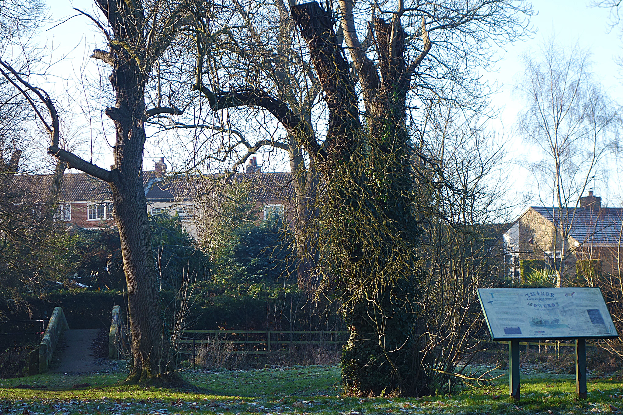
Return to the main path by the river which crosses pasture land and terminates near World’s End Bridge. Cross the road for the Pack Horse Bridge and board 12.
The Pack Horse Bridge is one of several found in Yorkshire. It is built of sandstone and has one arch that spans the Cod Beck. The high arch not only followed the architectural design of the times but allowed for the rise in river levels following heavy rain on the Hambleton Hills which lie to the east.
The bridge, listed by English Heritage, was built in 1672 with the aid of a grant of £20, an enormous sum in those days, and formed part of the transport network when pack horses were used to convey goods around the country. It provided a link, via Oldstead and the Sutton Road, between the Drovers’ Road, which passes along the western edge of the Hambleton Hills and which formed part of an ancient north/south route from the Scottish Borders to Brough, a town on the River Humber, and the larger towns to the west of Thirsk and Sowerby.
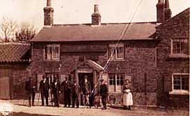
The World’s End was the name often given to a public house that stood at an isolated spot. The pub was built by Thomas Dodsworth in1835 close to the Cod Beck and the ancient pack horse bridge. For carters on their way out of Sowerby, it was the last chance for refreshment before setting off down the road to Dalton and for others it was a chance to have a drink while the horses were watered in the beck. Business fell off once the road bridge was built and the pub closed for good in 1911.
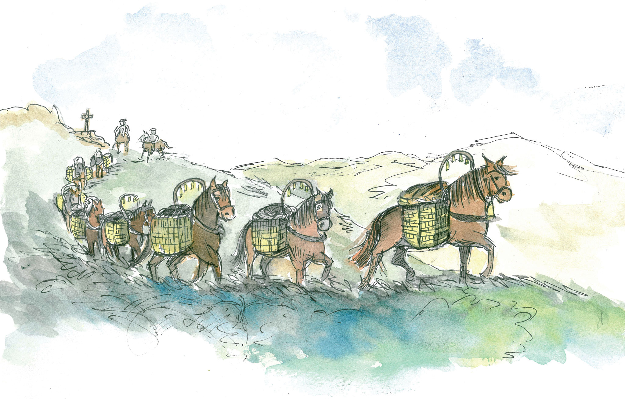
In the 17th century pack horses, walking in single file, carried heavy loads in panniers strapped to either side of their body. They travelled some 20 miles a day and the leading horses wore bells to warn of their approach. The string of horses was looked after by a man known as a ‘jagger’. Like many others, this pack horse bridge is narrow, 5 feet (152 cms.) wide and the low parapets 2.5 feet (76cms.) allow clearance for the panniers the horses carried. Some goods carried to this area might include coal, while farm produce, such as butter and cheese, would be taken to the large towns further afield.
The bridge was the only dry-shod crossing of the Cod Beck at the south end of Sowerby village and was widely used by pedestrians.
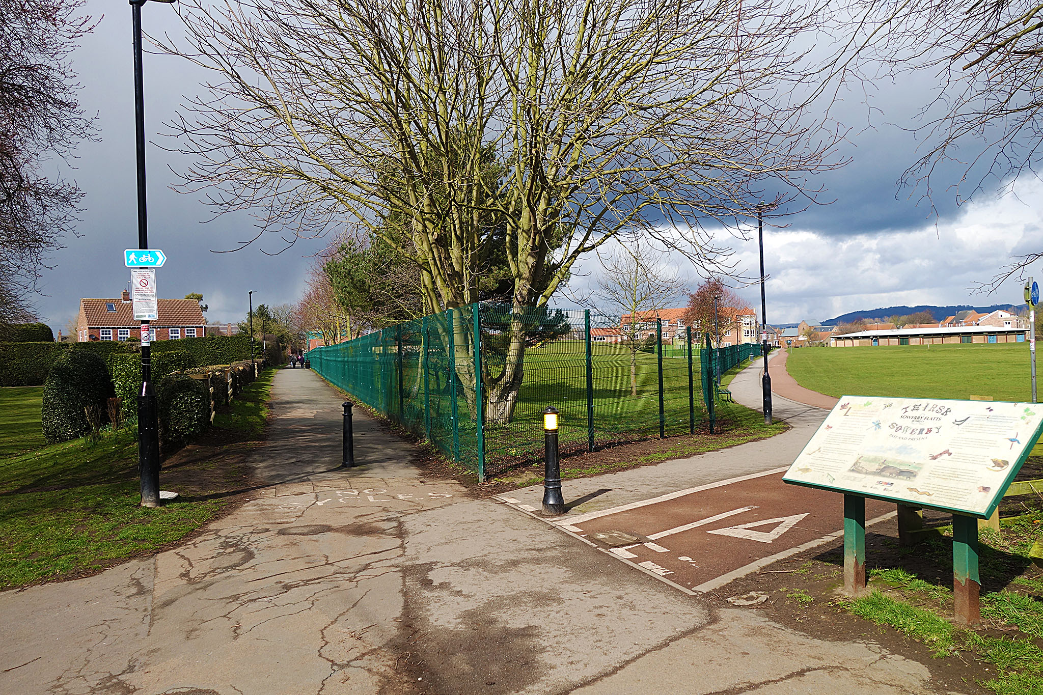
Board 13: Sowerby Flatts
Walk over the narrow pack horse bridge and take the right hand path which follows a green lane to join Back Lane. The house on the right was once the notable World’s End public house. Turn right and go down the gentle slope to join Front Street, the main street of Sowerby. Turn left and walk up the street.
Notice the timber-framed house on the left at the junction with Gravel Hole Lane and the large houses on either side of the street built by the prosperous business people of the town. Also note the three Regency houses on the right with steps up to the entrance over the basement.
Just before the church on the right is an ancient house called Manor Farm. A building has been on this site since 1304. Note the splendid dovecote in Manor Farm field.
Detour to see St Oswald’s Church, dating from about 1140, with its Norman door on the south side. Continue up the street to find board 13 which is on the right near the The Flatts.
Long a parish in its own right, the township of Sowerby was once a chapelry of the parish of Thirsk. There is in its name, evidence of its ancient Danish origins in which language the syllable "by" signified originally a single estate or farm, later a town or village.
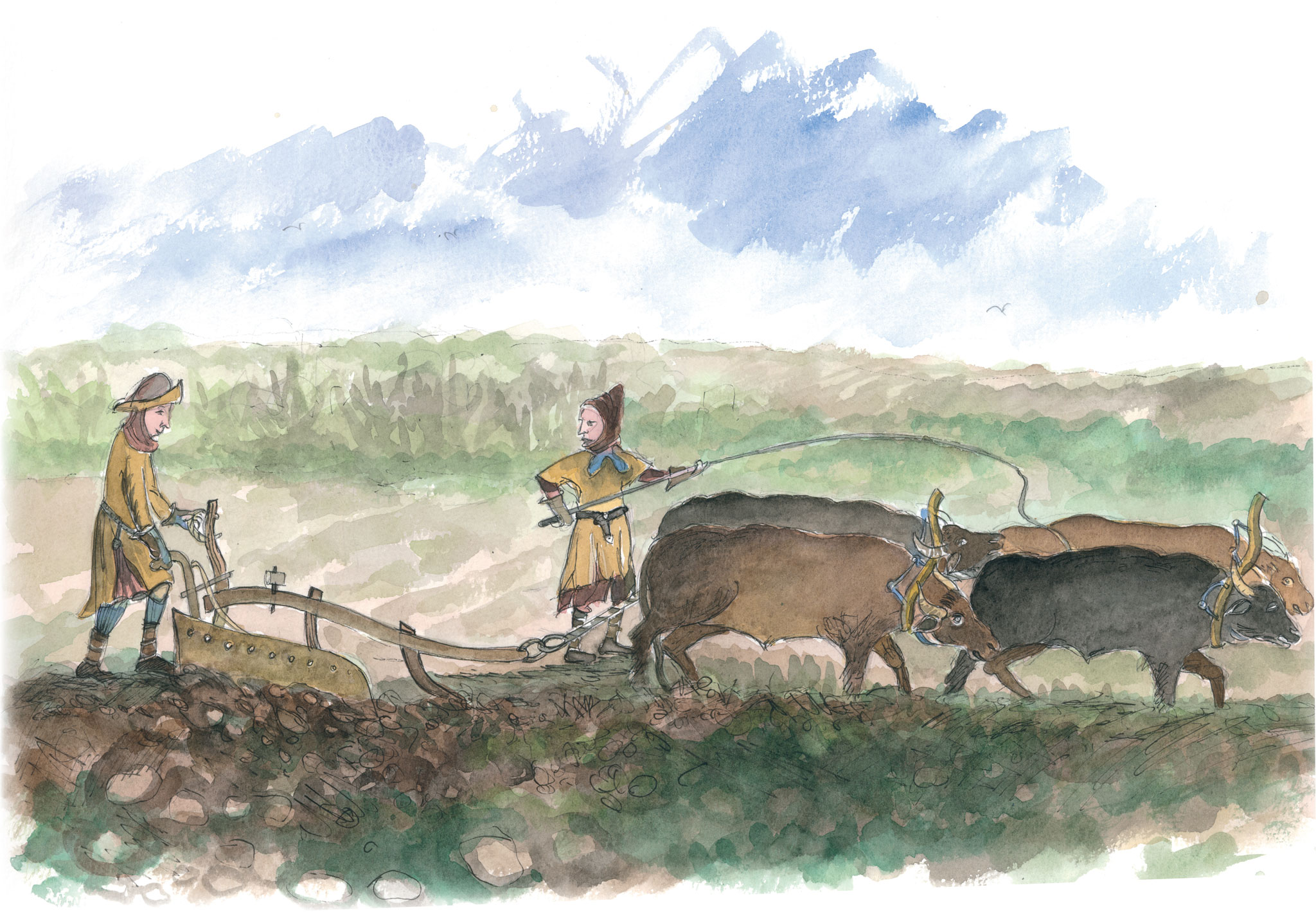
In medieval times the land would have been cultivated using a wooden plough and a team of oxen. The action of ploughing over the years left furrows where the earth was cut along the length of the land and ridges where the soil heaped up beside the furrows. The corrugations increased the land surface in which crops could be grown and the furrows helped with water drainage in wet weather.
Seed was scattered by hand and children acted as scarecrows over the following months by scaring away birds that would try to eat the seed and young crops, which were mainly wheat, oats, barley and peas.
Evidence of ridge and furrow farming can still be seen today in the area known as Miss Warner’s Field and in other fields along the Cod Beck.
A much wider variety of crops would have been grown in the past for local trade and manufacturing, including flax for weaving into linen, long-stemmed wheat for roof-thatching and hemp for rope making.
In 1798 an Act of Parliament was passed for enclosing the open town fields of Sowerby, most of which were converted from arable to grassland or "flatts", the term used for open grazing land.
In the 18th century canal systems were developed for the transport of merchandise. Lock Bridge was built using stone from an unfinished lock, which would have formed part of the planned canal system for the Cod Beck but the project was abandoned (see Canal Wharf board 10).
The Thirsk and Sowerby Flatts Preservation Trust (a charity) was established in the 1950s to administer the area. The Flatts were purchased by the community in 1959. As well as providing grazing for sheep and cattle this is a favourite place for recreation and outdoor activities.
The Swimming Pool, built on Flatts land, was the only one in England at that time (1971) to be built by public subscription, following the earlier death by drowning of three local boys in the River Swale and the Cod Beck.
In 2002 permission was granted by the Thirsk & Sowerby Flatts Preservation Trust for the restoration of native plant species in Miss Warner’s Field. In the emerging meadowland and hedgerow can be seen plants which, under traditional farming practices, were a source of food, medicines and materials. The area also provides a rich habitat for wildlife.
Miss Warner, more widely renowned as Mrs Pumfrey in the books of James Herriot, bought the field to preserve the view from Thorpe House, her house across in Sowerby Road, and in 1976 gave the field to the Thirsk & Sowerby Flatts Preservation Trust. In the distance can be seen the Hambleton Hills.
Board 14: Thirsk history
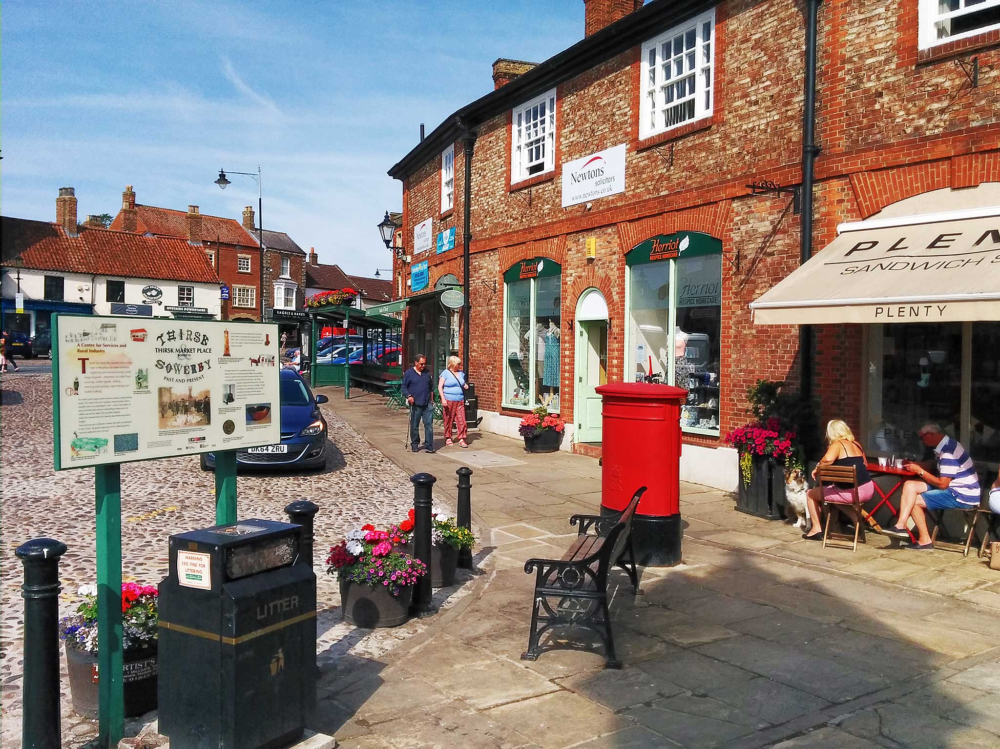
Follow the footpath to the left of the playground to reach Westgate. To the left is the Ritz Cinema, the Town Hall and a little further along, situated in the former Courthouse, the Rural Arts Centre. Return to the cinema, turn left into Castlegate, walk the length of the street and re-enter the Market Place. Here boards 14 & 15 are located in the middle of the square, near to Thirsk Tourist Information.
‘A Centre for Services and Rural Industry’ — Thirsk has been the market town of the Vale of Mowbray for nine centuries, supplying and manufacturing a wide range of goods. Industries included linen weaving, leather goods, milling, brewing and malting, rope making and basket making.
The market used to supply poultry and dairy products to West Yorkshire dealers. The centre of the town contained covered butchers’ stalls or shambles which were demolished in 1857. A relic of the tradition of open air butchery that survives is the Bull Ring, marked out in the cobbles near the bus shelter. This was where medieval market laws required bulls to be baited by dogs before being sold for slaughter. There used to be also a Tollbooth or Market Hall which was destroyed by fire in 1834. The general appearance of the cobbled square has remained unaltered for over 150 years.
An ancient market cross was replaced by the clock tower, built in 1896 to commemorate the marriage of the then Duke of York. As well as the clock indicating the time, therewas a water trough for animals at the base and a drinking fountain for people.
The leather trade was for a considerable time the staple industry of the town and both tanning and saddlery were undertaken. Thirsk was noted for its fine ales and four breweries and thirty or more inns and public houses have existed over the years. One of these breweries, worked by the Rhodes family in the early nineteenth century, can be seen in Kirkgate. Though the building, now called Brewers Court, has been converted into housing, much of the external structure has been retained and the chimney is still a prominent feature.
Board 15: The stagecoach era
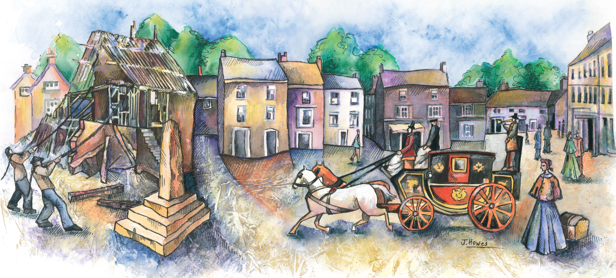
The final board is just a few steps away on the other side of the clock, by the road.
Thirsk is first mentioned in the Domesday Book of 1086, where it is recorded as Tresche, meaning "The Dwelling by the Water". The names of the narrow streets leading off the Market Place are Norse. Their bends and twists had a defensive purpose and denied hostile forces a clear view into the enclosure of the market place.
The market place has buildings of many ages, its general aspect being a Georgian façade behind which is concealed much earlier timber-framed buildings. It also included B. Smith’s which was the oldest draper’s store in the country (demolished in the 1970s).
The development of turnpike roads in the mid-eighteenth century made coach travel much easier. Stagecoaches were a popular mode of transport and Thirsk derived great prosperity as a stopping place for coaches. There were three coaching houses of which two - The Golden Fleece and The Three Tuns - still stand today.
At one time the Golden Fleece had between fifty and sixty horses in its stables and the Three Tuns about twenty. Famous coaches that used to stop included Royal Mail, Highflyer, Wellington, Expedition, Shields Mail, Newcastle Union, Victoria, Phoenix, Times and Hero.
The average speed of stagecoaches was nine and a half miles per hour. In 1786 Highflyer created a record London to Edinburgh time of just over twenty- four hours.
Coach travel declined once the railway reached the town in 1841 and, although the mainline station is a mile or so out of town, there was a Leeds via Ripon to Thirsk line which terminated where Tesco’s supermarket is now located. The years that followed the arrival of the railways marked the peak of Thirsk’s industrial importance. Thirsk is still on national routes for modern coaches recognising its important location.